1. ऊर्जा का स्रोत:
सुदूर संवेदन की प्रक्रिया के लिए ऊर्जा का स्रोत (विद्युत चुम्बकीय विकिरण) एक शर्त है। ऊर्जा स्रोत अप्रत्यक्ष (जैसे सूर्य) या प्रत्यक्ष (जैसे रडार) हो सकते हैं। अप्रत्यक्ष स्रोत समय और स्थान के साथ बदलते हैं, जबकि प्रत्यक्ष स्रोतों पर हमारा नियंत्रण है। ये स्रोत तरंग दैर्ध्य क्षेत्रों में विद्युत चुम्बकीय विकिरण (ईएमआर) का उत्सर्जन करते हैं, जिसे सेंसर द्वारा महसूस किया जा सकता है।
2. वायुमंडल के साथ विद्युत चुम्बकीय विकिरण की सहभागिता:
ईएमआर स्रोत से पृथ्वी की विशेषताओं और पृथ्वी की विशेषताओं से सेंसर तक यात्रा करते समय वातावरण के साथ बातचीत करता है। इस पूरे पथ के दौरान ईएमआर ऊर्जा के नुकसान और तरंग दैर्ध्य में परिवर्तन के कारण अपने गुणों को बदलता है, जो अंततः संवेदक द्वारा ईएमआर की संवेदनशीलता को प्रभावित करता है। यह इंटरैक्शन अक्सर वायुमंडलीय शोर की ओर जाता है ।
3. पृथ्वी की विशेषताओं के साथ विद्युत चुम्बकीय विकिरण इंटरैक्शन
पृथ्वी पर ईएमआर की घटना विभिन्न तरीकों से बातचीत करती है। यह सुविधाओं और जमीन की वस्तुओं द्वारा परावर्तित, अवशोषित, संचारित और उत्सर्जित होता है। ईएमआर परावर्तित, अवशोषित, संचारित और उत्सर्जित की मात्रा संपर्क और ईएमआर में सामग्री के गुणों पर निर्भर करती है।
4. सुदूर संवेदन सेंसर द्वारा ईएमआर का पता लगाना
सुदूर संवेदन डिवाइस पृथ्वी की विशेषताओं के साथ बातचीत के बाद सेंसर में आने वाले ईएमआर को रिकॉर्ड करता है। डिवाइस द्वारा जिस तरह की विद्युत चुम्बकीय विकिरण को महसूस किया जा सकता है वह विद्युत चुम्बकीय विकिरण और सेंसर की क्षमताओं पर निर्भर करता है।
5. डाटा हस्तांतरण और प्रसंस्करण
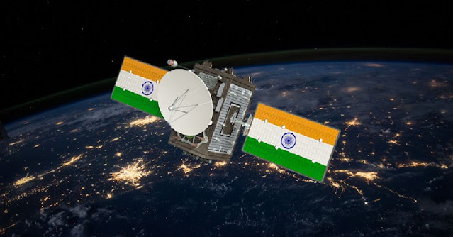
रिमोट सेंसिंग डिवाइस द्वारा दर्ज की गई विद्युत चुम्बकीय विकिरण को पृथ्वी प्राप्त करने और डेटा प्रोसेसिंग स्टेशनों में प्रेषित किया जाता है। यहां ईएमआर व्याख्यात्मक आउटपुट- डिजिटल या एनालॉग छवियों में बदल जाता है।
6. छवि प्रसंस्करण और विश्लेषण
डिजिटल उपग्रह छवियों को उपग्रह छवि प्रसंस्करण के लिए विशेष सॉफ्टवेयर का उपयोग करके संसाधित किया जाता है। छवि प्रसंस्करण और उपग्रह डेटा के आगे के विश्लेषण से सूचना निष्कर्षण होता है, जो उपयोगकर्ताओं द्वारा आवश्यक है।
7. अनुप्रयोग
निकाली गई जानकारी का उपयोग विशेष समस्याओं को हल करने के लिए निर्णय लेने के लिए किया जाता है। इस प्रकार सुदूर संवेदन एक बहु-विषयक विज्ञान है, जिसमें विभिन्न विषयों जैसे प्रकाशिकी, फोटोग्राफी, कंप्यूटर, इलेक्ट्रॉनिक्स, दूरसंचार और उपग्रह-प्रक्षेपण आदि का संयोजन शामिल है।
The process of remote sensing involves many processes ranging from energy emission to data analysis and information extraction. The stages of remote sensing are described in the following steps:
1. Source of energy:
The source of energy (electromagnetic radiation) is a prerequisite for the process of remote sensing. Energy sources can be indirect (eg sun) or direct (eg radar). Indirect sources change over time and space, while we have control over direct sources. These sources emit electromagnetic radiation (EMR) in the wavelength regions, which can be sensed by the sensor.
2. Interaction of electromagnetic radiation with the atmosphere:
The EMR interacts with the atmosphere while traveling from the source to the earth and the characteristics of the earth to the sensor. Throughout this path the EMR changes its properties due to the loss of energy and changes in wavelength, which ultimately affects the sensitivity of the EMR by the sensor. This interaction often leads to atmospheric noise.
3. Electromagnetic Radiation Interactions with Earth's Characteristics
The occurrence of EMR on Earth interacts in various ways. It is reflected, absorbed, transmitted and emitted by facilities and ground objects. The amount of EMR reflected, absorbed, transmitted and emitted depends on the properties of the material in the contact and the EMR.
4. EMR detection by remote sensing sensor
The remote sensing device records the EMR coming into the sensor after interacting with the Earth's characteristics. The amount of electromagnetic radiation that can be sensed by the device depends on the electromagnetic radiation and the capabilities of the sensor.
5. Data transfer and processing
Electromagnetic radiation recorded by a remote sensing device is transmitted to earth receiving and data processing stations. Here EMR turns into interpretive output- digital or analog images.
6. Image Processing and Analysis
Digital satellite images are processed using specialized software for satellite image processing. Image processing and further analysis of satellite data leads to information extraction, which is required by users.
7. Applications
The extracted information is used to make decisions to solve particular problems. Thus, remote sensing is a multi-disciplinary science, involving a combination of various disciplines such as optics, photography, computers, electronics, telecommunications and satellite projection.

Comments
Post a Comment